
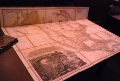
We were asked to bring out some of our maps to show them off to visitors from nearby institutions. We pulled out a fraction of the maps we have in our collections and set them up on display. The major part of the display can be seen at our Flickr page. The image shown is Henry S. Tanner’s 1822 A Map of North America, a very important map in the exploration of the American West. The maps displayed today were:
- Coll. No. 2002.010 H.J. Weller trench maps and case. We have a large assembly of WWI trench maps, although these are a very nice example.
- Coll No. 1978.008 Kent Frizzell Wounded Knee papers, Wounded Knee area map.
- State of Sequoyah.
- F436 .R36 1853 The Annals of Tennessee
- F594 .D63 1877 The Hunting Grounds of the Great West (map housed separately in map case 2)
- Map 000030. General Topographical Maps Accompanying the Official Records of the Union and Confederate Armies, 1861-1865.
- Map Exhibiting the Line of the Southern Trans-Continental Railroad…
- G4300 1822 .T36 Henry S. Tanner’s 1822 A Map of North America
- Department of the Interior Oil and Gas Fields of the State of Oklahoma.
- Map 000001 Railroad Map of Oklahoma, 1909
- Map 000065 Norman’s Plan of New Orleans and Environs, 1854
- Map 000063 Mitchell’s Travellers Guide Through the United States, c1833
- Map 000032 Missouri Territory (Formerly Louisana) by Matthew Carey, c1814
- Map 000036 Americae Mappa Generaus, c1746
- Map 000064 A Geographically Correct County Map of States Traversed by the Atchison Topeka and Santa Fe Railroad…, c1876
- Map 000060 Map of the State of Louisiana Mississippi and Alabama, c1839
- F788 .D9 1882 Atlas +Oversize US Geological Survey Atlas to Accompany the Tertiary History of the Grand Canon District
- F1211 .H9 1812 Atlas +Oversize Alexander von Humboldt’s 1803 Map of Kingdom of New Spain (published 1812)
- G1100 .J44 1776 +Oversize Thomas Jefferys’ 1776 The American Atlas
- G1366 .F1 S75 1922 +Oversize Atlas of Texas Map Exhibits in the Supreme Court of the United States
- Coll. No. 2011.040 Robert Pickering WWII maps
These two maps, one US and one Japanese, both of the Philippines, are also our most recent acquisitions.
The Department did an online exhibit of some of our historical maps back in 2007.